


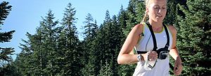


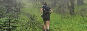


Water Adventures
come cool off this summer
Select from the categories below.
Come cool off this summer in Ashland!
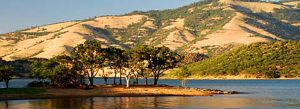
Ashland has ten lakes and five major rivers within a short drive that provide access to swimming, boating, kayaking, jetboating, rafting, fishing and more. To learn more see below about the Rogue River, Upper Klamath Rivers, Crater Lake National Park and the Mountain Lakes region page for more in depth information regarding each lake. Whether you want to leisurely float, experience some awesome whitewater, fish or kayak, we have some of the best outfitters and guides available! Visit our Water Adventure Members!
The Rogue River
The Rogue Wild and Scenic River is best known for its outstanding natural scenery, fishing, whitewater boating, and wildlife and cultural resources. Eighty-four miles of the Rogue River was designated wild and scenic by Congress in 1968, under the Wild and Scenic Rivers Act, to preserve its outstanding qualities. The Applegate River (7 miles west of Grants Pass, Oregon) is the east boundary and Lobster Creek (11 mile east of Gold Beach, Oregon) is the west boundary. The area gets over half a million visitors, annually. Recreation opportunities include: driving for pleasure, boating, fishing, guided motorized tour boat trips, guided whitewater fishing and float trips, camping, hiking, swimming, picnicking, wildlife viewing, sun bathing and gold panning. The small towns of Galice and Agness are within the river corridor and have gas, lodging and food available May through September.
Recreation facilities include: 12 lodges, 1 RV Park, 10 campgrounds, camping and day use opportunities at 100 undeveloped sandy beaches along the banks of the river, 54 miles of trail, the Smullin Visitor Center at Rand, 4 National Historic Sites, the Rogue Wilderness and 15 boat launch sites.
Use of the Wild and Scenic section of the Rogue River is regulated each year, from May 15 through October 15, to protect the river corridor from overuse and to provide a wild river experience. During this time, 120 commercial and noncommercial users may obtain special-use permits to enter the Wild section each day. Permits for the regulated use period are originally allocated through a computer selection process, or “lottery.” The annual application period for the permit lottery is December 1 through January 31. From April 1 through October 14, available permits are distributed through a first-come/first-served telephone process. Permits and details on the permit process are available at: River Permits and Information Phone: 541-479-3735 Smullin Visitor Center at Rand 14335 Galice Road Merlin, Oregon 97532 or click here
People travel from around the country to fish and fly fish on the Rogue River. Note the Key that lists the many fishing holes on this map. Or go with a Guide. A fishing license is required. Fishing licenses can be purchased at Ashland Fly shop in downtown Ashland, at BiMart in the Tolman Creek Plaza or go online to www.dfw.state.or.us . In the spring, Salmon run in May and June. Fall is the primary time for fishing with Chinook Salmon running in August and September and Coho Salmon in late October. Fall steelhead run September through the winter.
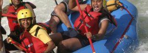
If you want to enjoy the river on boat, raft or kayak, there are many skilled guides and outfitters that offer half day, full day and multi day river trips for rafting and fishing. Many of them will pick you up in Ashland or are based here. Whether you are looking for a mellow afternoon float or exhilarating adventure, there is something for everyone. Go to www.ashlandchamber.com to find out more about getting on the river. Many local kayakers enjoy boating on the Rogue as well.
Take a Half Day and Full Day River Trip…
Most half day river trips starts below Lower Table Rock and concludes at Gold Hill. A scenic setting starting with mellow riffles and rapids, uniquely progressing from class 1 introductory rapids to the exciting but safe class IV whitewater. Walk around option is available on the two class IV rapids. Mellow stretches between the rapids allow river goers to play games, swim and enjoy river time. Beautiful scenery, sparsely populated and variety of birds and waterfowl add to the many memorable pleasures. Half day trips run 3 – 4 hours.
Full day trips run 6 – 7 hours and enable you to see more of the Rogue River or the Upper Klamath River east of Ashland. Most outfitters put in for the full day at Touvelle State Park and head downstream. After mellow rapids, the second half involves fun rapids including Powerhouse and takes out at Gold Hill.
There are many river features to enjoy on the Rogue River, some of which are on this section of the river noted on this map. The rapids range from Class I to Class V. Whether by raft, kayak or boat, it is important to know the river. The European Rapid Rating System Whitewater rapids are rated on a scale of one through six, indicating the difficulty of each rapid at medium water level. CLASS I Very Easy – small, regular waves and riffles; few or no obstacles; little maneuvering required. CLASS II Easy – small waves with some eddies, low ledges, and slow rock gardens; some maneuvering required. CLASS III Medium – numerous waves that are high and irregular; strong eddies; narrow, but clear passages that require expertise in maneuvering; scouting from the shore necessary. CLASS IV Difficult – long rapids with powerful, irregular waves, dangerous rocks, and boiling eddies; precise maneuvering and scouting from the shore imperative; take all possible safety precautions. CLASS V Very Difficult – long rapids with wild turbulence and extremely congested routes that require complex maneuvering; a danger to your life and boat and near the limits of navigation. CLASS VI The Limits of Navigation – rarely run; a definite hazard to your life. These definitions are constant and unchanging; however, personal interpretation can vary. The same rapid may be rated a Class III by one person and a Class IV by someone else. You must determine for yourself the degree of difficulty of any particular rapid. Remember that fluctuating water levels can change the difficulty ratings for rapids. Higher flows make the water more powerful and cover up more rocks. Lower water makes the rapids more technical with more rocks to miss. On the Rogue River, flows below 1,200 cfs are considered low; flows above 6,000 cfs are considered high. Normal spring and summer flows are usually between 4,000 and 1,200 cfs.
Touvelle State Recreation Site is a beautiful day-use park located on the bank of the Rogue River and at the foot of the geologically prominent Table Rocks. You can fish, swim, hike, watch wildlife and experience nature at its finest. An ideal spot for family gatherings and group picnics, the has a large picnic shelter with cooking facilities. There’s a smaller picnic kitchen and three sites with water and electricity. Denman Wildlife refuge is located next to the park and has local and migratory wildlife. A boat ramp with toilet facilities provides excellent access to the river.