Getting Here
13 direct flights and the perfect road trip destination
Select from the categories below.
Traveling to Ashland
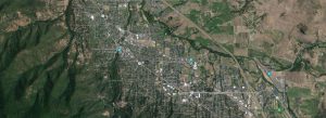
Ashland is centrally located halfway between Portland, Oregon and San Francisco, California. Ashland is located 15 miles from the California border easily accessed from Interstate 5. Once you arrive, we invite you to enjoy navigating Ashland as a driver, pedestrian or cyclist. For trails and bike routes request an Ashland Map Guide.
By air:
Rogue Valley International Airport (MFR), located 15 miles north of Ashland in Medford with 13 direct flights throughout the West coast.
Ground transport available through shuttle and cab services. Rental car services include Alamo, Budget, Hertz, National and Enterprise. Uber and Lyft are available from the airport to Ashland. For taxis you can call Crater Lake Taxi @ 541-333-3333 or Cascade Airport Shuttle: 541-488-1998.
By train:
AmTrak’s stations are 70 miles East in Klamath Falls, OR and 75 miles south in Dunsmuir, CA. Daily bus service provided by Greyhound-Trailways and the Southwest POINT. The SouthWest POINT leaves from Stadium Street at Ashland Street twice daily, traveling west to Brookings via Medford and Grants Pass, and east to Klamath Falls to connect with trains to points beyond Sacramento (including San Francisco) and ending in Los Angeles. Tickets for the Southwest Point must be purchased through Greyhound, Amtrak or via the Pacific Crest Bus Lines website. Visit oregon-point.com for the most up-to-date information.
By bus:
Rogue Valley Transportation District (RVTD) provides public transit service Monday - Saturday throughout Ashland and the Rogue Valley. www.rvtd.org
Click below for our members!
Transportation and Travel Services
What to do if smoke is in the air: In the West, our environment at times can create some challenges for visiting our town. One such occurrence can be smoke in the air due to wildfires in the region. For air quality and helpful resources go to www.smokewiseashland.com


