


Hiking & Trailrunning
miles of scenic trails
Select from the categories below.
From peaks to playtime, miles of trails await you to enjoy
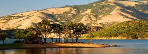
Ashland is a place of unique beauty surrounded by hills of green and nestled at the base of the Ashland Watershed within the picturesque Siskiyou Mountains.
The U.S. Forest Service, the City of Ashland and community members have a long commitment to high quality water while providing unique recreational opportunities in the forest surrounding Ashland. Today the watershed boasts a trail system of 50 miles that extends from the paved streets of Ashland to the alpine scenery at Mt. Ashland. The 15,000 acre watershed offers numerous trails for hikers, mountain bikers and equestrians.
Source: AshlandWoodlands Trails Association. Learn more about the work and mission of Ashland Woodlands Trails Association
Voted one of the Top Trail Towns by Trail Runner Magazine, Ashland has its own culture of runners. Rogue Valley Runners serves as one of the outfitters to all your trail running needs, including knowledge of the trails and a weekly running group. By sharing the trail, runners, hikers and bikers can all enjoy the quiet beauty that Ashland's trails have to offer.
Interested in an event or race? Ashland is the ideal base camp destination for it! To learn more about Ashland’s outdoor events see our Outdoor Page.
Trails in and around Ashland include:
Lithia Loop Trail
Grizzly Peak Trail
Looking Glass Loop
White Rabbit Trail
The Pacific Crest Trail
And so many more! To learn more, check out the Ashland Map Guide with maps of the Ashland Watershed, City Streets and Lithia Park produced by Travel Ashland. The georeferenced version of our Ashland Map Guide is also available on www.avenzamaps.com or download the app.
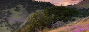
Many, depending on the time of year, offer a special show of wildflowers.
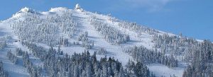
Summertime, take a day hike on the Pacific Crest Trail that passes within 100 yards of Mt. Ashland summit that can be accessed from Mt. Ashland parking lot. Grouse Gap Shelter is 1.5 miles from the back-parking lot – a shelter on the PCT. See Ashland Map Guide for more information. From Mt. Ashland to the North, you can see amazing views of the Rogue Valley and Rogue River-Siskiyou National Forest. To the South soak in the views of Mt. Shasta, sitting at 14,180’ elevation in the Shasta-Trinity National Forest in California.
The PCT leads north to the nearby Cascade Siskiyou National Monument – trails, vistas, unmatched biodiversity at the convergence of the Cascade and Siskiyou mountain ranges. It is the Top 5 most biodiverse temperate forest in the world and home to 3500 species and 125 of the 160 butterfly species in Oregon.